.jpeg "Hai Phong Power Company works urgently to restore storm-affected grid")
-e0e55ad389dbeeef14a8468464c3bba2.jpeg "Hai Phong businesses take proactive steps ahead of Storm Wipha")


Gửi bình luận
From the night of July 22 through July 23, heavy to very heavy rainfall is forecast to occur across the northern and central regions, accompanied by risks of thunderstorms, whirlwinds, lightning and strong winds, particularly in coastal areas.
The National Center for Hydro-Meteorological Forecasting has issued warnings for the night of July 22 through July 23, forecasting heavy to very heavy rainfall across the northern and central regions, accompanied by risks of thunderstorms, whirlwinds, lightning and strong winds, particularly in coastal areas.
In Ha Noi, moderate rain is expected, with some localised heavy downpours and thunderstorms. Northeasterly to easterly winds will blow at level 2 – 4, with potential for whirlwinds, lightning and strong gusts during storms.
In the northwest region, widespread showers and thunderstorms are expected, with heavy to extremely heavy rain in southern areas of Phu Tho and Son La provinces. Winds will remain light. Whirlwinds, lightning and gusty winds may occur during storms.
The northeastern region also expects moderate rain with isolated heavy showers and thunderstorms.
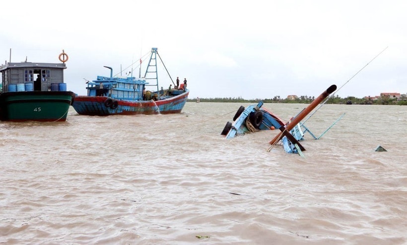
Particularly, coastal areas of central Thanh Hoa and Nghe An provinces may experience strong winds at level 6 – 7 at night, up to level 8 near the storm centre with gusts at level 10. Inland areas of Thanh Hoa may face winds of level 4 – 5, gusting to level 6.
")
The center also warned of strong winds at level 6 in sea areas from Khanh Hoa to Lam Dong and the central East Sea. Wave heights may reach 2 – 3.5 m, and sea conditions will be rough.
A level 2 disaster risk alert has been issued for maritime areas due to strong winds. All vessels operating in the affected zones face a high risk of whirlwinds, strong winds and large waves, according to the centre.
The center also reported that from 1 pm to 4 pm on July 22, the storm remained largely stationary.
It said that by 4 pm, the typhoon's centre was located at approximately 20.1 degrees North latitude and 105.9 degrees East longitude, over the land area between the provinces of Ninh Binh and Thanh Hoa. The strongest winds near the centre reached level 8 (62 – 74 km per hour), with gusts to level 10. The storm was moving westward at a speed of 10 – 15 km per hour.
Forecasts showed that by 4 pm on July 23, the storm will have moved west-southwest into northern Laos and weakened into a tropical depression, then into a low-pressure area. Wind speeds are expected to drop below level 6.
Affected areas include the western part of the Gulf of Tonkin, as well as coastal and mainland areas of provinces from Quang Ninh to Nghe An. The natural disaster risk level has been set at level 3.
TB (according to VNA)